Thursday, August 29, 2013

2013 August, Heading East Once Again!

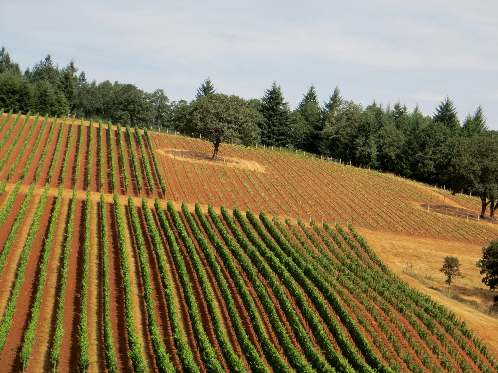
 Sunday, August 18, it was time to begin heading East once again.  We left McMinnville, Oregon and drove through Portland and headed east along the Columbia River.  It was a bit foggy along the river but the drive was still beautiful!.  We drove through Walla Walla, Washington and the many wheat fields.  We finally made our way to Clarkston, Washington for the night.  We were going to stay here for two nights, however they only had space for one night (and that turned out to be good, more later). 

Monday morning we left Clarkston and headed
across Idaho along US Route 12.  US Route 12 is a federal highway in north central Idaho.  It extends 174.210 miles from the Washington state line in Lewiston east to the Montana state line at Lolo Pass,  generally along the route of the Lewis and Clark expedition, and is known as the Northwest Passage Scenic Byway.

US 12 was created in 1925 as part of the original system of United States highways, and its original western terminus was in Miles City, Montana.  In 1962, the highway was extended west to Lewiston, ending at the former US 410.  In 1967, it was extended to its current western terminus in Aberdeen, Washington, with the Idaho section
 taking its current route.

The Lewis and Clark Highway, from Lewiston eastward to Lolo Pass, was designated State Route 9 in 1916 and construction began in 1920.  Federal prison labor was used in the late 1930's and Japanese internment labor was used during the last two yeas of World War II, working out of the Kooskia Internment Camp, six miles upstream of Lowell.  By the fall of 1955, 27 miles remained unfinished, and upon its completion in 1962, its completion in 1962, it was re-designated US12.  At the August dedication at Lolo Pass attended by thousands, the states' governors, Bob Smylie of Idaho and Tim Babcock of Montana, cut through
a ceremonial cedar log with a two-man crosscut saw.


We knew that there was forest fires in Idaho and before we left Lewiston, we called and were informed that route 12 was indeed open.  As we drove along the road, we came to the town of Orofino and the air was filled with smoke.  We did not see any active fires at this point so continued on our way.  It was not long and we were out of the smoke are and continues along the Clearwater and Lochsa Rivers.  I have to say that this was a beautiful drive, however the road was very curvy as it followed the rivers  I enjoyed the drive,
but I am not sure this is one of John's favorite
drives!


 This beautiful Idaho byway commemorates the 1803-1806 expedition by Meriwether Lewis and William Clark to find the most practicable water route between the Missouri River and the Columbia River through the unexplored Rocky Mountains.  It follows the US Highway 12 corridor from Lolo Pass to Lewiston along the beautiful Lochsa and Clearwater Rivers, paralleling the Northern Nez Perce Trail followed by Lewis and Clark and passing through Nez Perce Indian country.

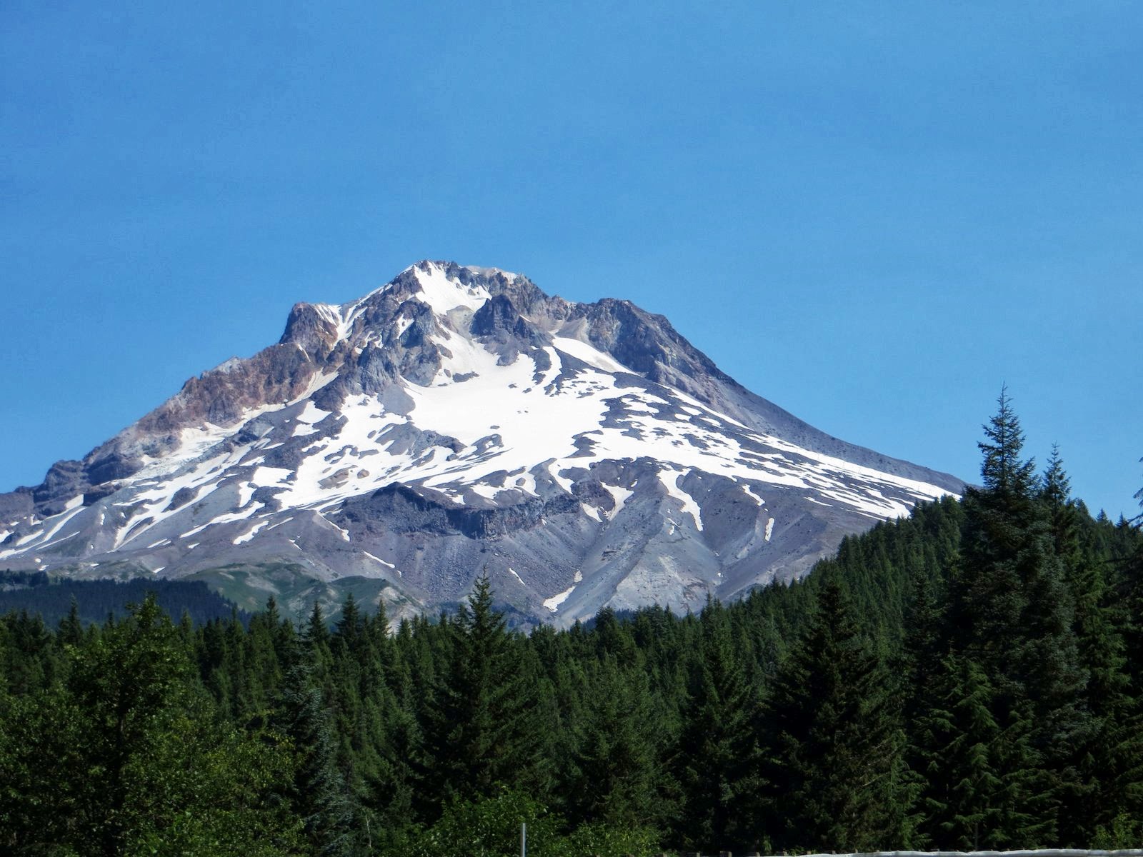
We reached Lolo Summit at 5,233 feet.  We stopped at the ranger station for a break before we continued on to Missoula, Montana.  The information at the pass stated that the Lewis and Clark party crossed this pass on September 13, 1805, westbound for the Pacific after a long detour to the south.  From the headwaters of the Missouri River they crossed the mountains to the Salmon.  Finding that river impassable, they traded for pack-horse's, hired an Indian guide, and came north to an Indian trail across the mountains here.  Tired and ill-fed, the men were to have a hard struggle in early snow along the steep ridges which the trail followed for most of its 125 mile course west to the Clearwater River.

After crossing Lolo Pass we continued into
 Montana.  Our destination was Missoula.  Just prior to entering the town of Lolo we noticed the clouds in the sky and knew they were clouds from a fire.  Then the sky turned all yellow and we knew that we were close.  As we rounded the mountain there on the hillside was a major fire.  There were signs not to stop along the road as there was a forest fire.  We did see the helicopter with a water bucket cross the highway and drop water along the fire.  If you look closely you can see the flames along the edge of the fire.

We passed this area and headed into Missoula.  Shortly after going by this area we heard that the road had been closed due to the fire and remained
closed for the next two days.  (So as I said earlier, we were lucky that Clarkston only had room for us for one night!)

Before heading to our Campground for the next several nights we decided to fill the tank at the local truck stop.  As we were filling the tank, another RV drove into the station and what to our surprise it was our friends, Chris and Jan.  We knew they were also heading east but were unsure of their route.  How fun to run into them, and what are the chances that we would both pull into the truck stop at the same time!?!?  So we had dinner together for the next several nights.

We stayed in Missoula for two nights at Jim and
Mary's RV Park.  We like it there as it is small park with lots of flowers and plenty of trees.

My friend Jan gave me the following information about Missoula to pass along.

The city of Missoula began as a tenuous settlement known as Hell Gate in 1860, when entrepreneurs C.P. Higgins and Francis Worden saw trade possibilities and opened a log store in the valley.

Although the Lewis and Clark expedition had traveled through the area in 1806, and British explorer David Thompson had charted it in 1812
 the nearest settlements - Fort Owen in the Bitterroot and St. Ignatius - remained tiny, and travelers were few.  However the search for gold and the completion in 1863 of the Mullan Road, which opened up travel from Fort Benton to Walla Walla, Washington, brought people to the valley.  The settlement became known as Missoula, taken from a Salish Indian word meaning "near the cold, chilling waters", and in 1866 became the county seat.  The first jail was built the same year, the first school in 1869 and the first newspaper established in 1871.

Missoula is a nice quiet place to stop and regroup.
There are many restaurants and good shopping before continuing east, along with NO sales tax.


From here we head to Billings, Montana for one night then on to Dickinson, North Dakota and on into the Twin Cities for a visit with family and friends.
We found that Summer had finally arrived in the Twin Cities as the temperatures for the week were predicted to be in the 90's!!


That is all for now, I think that we are about caught up on our travels for now.  More from along the road later.

Love to all,

Candy and Johnny
Posted by Picasa

Sunday, August 25, 2013

2013 August, Evergreen Aviation and Space Museum


We left Lincoln City and headed inland to McMinnville, Oregon.  We love to stay at the Olde Stone Village RV Park.  The park is right net to the Evergreen Aviation and Space Museum.  There is a path from the park through the wheat field to the museum.  You can walk over or if you call them, they will send a cart to pick you up at your RV site.

The Evergreen Aviation and Space Museum is an aviation museum which displays a number of military and civilian aircraft and spacecraft, most notably, the Hughes H-4 Hercules "Spruce Goose".  The museum is located in McMinnville, Oregon, across the street from the headquarters of Evergreen International Aviation.  An IMAX theater opened in 2007, and a second exhibit hall focusing on the Titan II ICBM and space technology opened in 2008.


 First envisioned by Capt. Michael King Smith, son of Evergreen International Aviation founder Delford Smith, the Evergreen Aviation and Space Museum is the realization of his dream.  The museum began with a small collection of vintage aircraft in a hanger at headquarters and was called Evergreen Museum.  In March 1990, the Disney Corporation, which owned the Spruce Goose, announced that it was closing its exhibit located in Long Beach, California.  The Aeroclub of Southern California was notified and they immediately began the search for a new home for the Spruce Goose.  In 1992, the Evergreen Museum won the bid with a proposal to build a museum around the aircraft and feature it as a central exhibit.


 When the Spruce Goose was in Long Beach, parked in a building next to the ship, The Queen Mary, I was fortunate to see the aircraft.  Have to say, the display was quite impressive, as the Spruce Goose was lit up under a black ceiling.  It really stood out and was something to see! (See photo below!)

In August 1992, the disassembly of the aircraft began.  The plane was disassembled and sent by ship up the Pacific Ocean, Columbia River and Willamette River to Dayton, Ore. where it was transferred to trucks and driven to Evergreen International Aviation.  It arrived in February 1993.

For the next eight years, the plane went through detailed restoration.  Volunteers removed all the paint, replaced worn parts and repainted the entire aircraft, among many other tasks.

In September 2000, the main aircraft assemblies were complete.  The fuselage, wings and tail were transported across the highway and into the new museum building, still under construction.  For the next year, crews spent their time assembling the wings and tail to the fuselage.  These were completed in time for the museum's opening on June 6, 2001.  The control surfaces (flaps, ailerons, rudder, and elevators) were assembled later.  The last piece was put into place on December 7, 2001.

The name of the museum has evolved:  Initially known as the Evergreen Museum, it changed in 1994 to the Evergreen AirVenture Museum.  In 1997, the facility was renamed the Captain Michael King Smith Evergreen Aviation Educational Center in memory of Captain Smith, who has lost his life in an automobile accident in March 1995.

A key component of the museum are the many volunteers that work there.  Many are former aviators who flew the planes on display.  Their detailed descriptions and real life commentary help bring the planes and their days of flight back to life.

As of June 2008, two exhibit centers were open to the public.  The primary structure is the aviation center with the Spruce Goose as centerpiece.  The space flight center holds a Titan II missile as its centerpiece, along with the SR-71 Blackbird.  The Titan II sits upright in a specially constructed display extending two stories below the floor, silo fashion.  The exhibit includes a re-created missile control room furnished with furniture and equipment donated from Vandenberg Air Force Base.  Attempts to obtain a retired Space Shuttle were unsuccessful.

Also on the grounds is a 71,350 square foot water park, which opened on June 6, 2011.


Also on the grounds of the museum is a 747 that is parked out front.  There are plans in the works to turn this aircraft into a Hostel.  There is a 747 parked in Sweden at the Arlanda Airport that has already been turned into a hostel there.  It offers about 29 rooms with single, two and three bed private rooms or two and four bed dormitories.  All together, the hostel offers 61 beds; the most luxurious is to be found on the planes upper deck which boasts an exclusive Cockpit suite with private shower and toilet.

Each room has a flat screen TV.  There is also access to wireless internet.  On the main level there are five modern bathroom and toilet facilities.  It also offers food and beverages along with microwave ovens for those who may bring their own food.

I have already slept on a 747 so this is not something that is on my bucket list!!!

See fun facts about the Spruce Goose below..

Until later,   Candy and Johnny


Posted by Picasa

Facts about the Spruce Goose


 The Spruce Goose is the largest airplane ever constructed, and flown only one time on November 2, 1947.  The Hughes Flying Boat represents one man's greatest attempts to conquer the skies.  The single prototype was built as a personnel and materiel carrier.  The aircraft was designed to fly trans-Atlantic to avoid the World War II German submarines that were sinking Allied ships.

To produce the giant, Howard Hughes and his staff worked from 1942 to 1947, spending $18,000,000 federal dollars and $7,000,000 of Hughes' own money.  Henry Kaiser, steel magnate and "Liberty" shipbuilder, conceived the idea of massive flying transports, and turned to Howard Hughes for aviation expertise.  Hughes took on the mammoth task, along with the government mandate not to use materials critical to the war effort (such as steel and aluminum).  Nearly six times bigger than any aircraft of its time, the Flying Boat is made out of wood!

The press insisted on calling the Hughes Flying Boat the "Spruce Goose".  A name that Howard Hughes despised.  The funny thing about the nickname is that most of the huge plane is actually made of birch, with only small amounts of maple, poplar, balsa, and yes, spruce.  Birch was chosen because testing proved it to be light, strong, and resistant to splitting, dry rot and deterioration.  The aircraft is mostly made of duramold, using laminated layers of birch veneer.  Glued together under heat and pressure, this plywood is so strong that if a piece of duramold is broken, it does not split along the glue lines.

Millions of nails were used and then removed.  To shape and form the wooden pieces needed to create the Flying Boat, seven tons of small nails were used.  Once the glue set, workers removed every nail.

The wingspan is longer than a football field!  If you place the Hughes Flying Boat on top of a football field, the wing tips would extend over both end zones.  The nose and the tail would extend well into the spectator sections.

The tail span is wider than the wingspan of a Boeing B-17, with a span of 113.5 feet while the B-17 is 103 feet, 9 inches.  The vertical tail rises nearly 80 feet in the air, the same as an eight story building.

Completed in 1947 after the end of World War II, the winged giant made only one flight.  The unannounced decision to fly was made by the pilot, Hughes himself, during a taxi test.  The flight went only a little over a mile at an altitude of 70 feet for about one minute.  But, the short hop proved to skeptics that the gigantic machine could indeed, fly!

The Hughes Flying Boat went into hibernation after its famous flight.  Stored away in its special hanger, it was out of the public eye for thirty-three years.  All the time, Howard Hughes kept the plane in immaculate shape and ready to fly.  It was rumored that it cost Hughes $1 million per year to preserve the aircraft.

After Hughes' death in 1976, it appeared that the Hughes Flying Boat was to be disassembled.  The giant plane was saved by entrepreneur Jack Wrather, who moved it into a massive domed hanger, next to the famous ocean liner, the Queen Mary, in Long Beach, California.  Beginning in 1983, the plane was put on public display.  In 1988, the Wrather Corporation was bought by Te Walt Disney Company.  Disney didn't see the plane in its future plans, so the search was on to find a new home for the aircraft.

The photo above of me sitting in the cockpit of the Spruce Goose was taken when the aircraft was in its Long Beach Hanger.  I do not remember the date that it was taken???

It was some aircraft!!!

That is all for now..... until later,  Candy and Johnny

Posted by Picasa

2013 August, Wine Country


 We left the Oregon Coast and headed inland to McMinnville and the Willamette Valley.  The Willamette Valley is between the Cascade Mountains and the Coast Range, more than 100 miles long and spanning 60 miles at its widest point, and home to more than 300 wineries.


 The Willamette Valley is known for its world class Pinot noir.  The wineries and tasting rooms are surrounded by beautiful vistas and views of the Cascade Mountains.  We explored the quiet back country roads leading to backyard tasting rooms and also state of the art wineries.  Found some good (and some not so good) wines.  We did manage to put a dent in the pocket with some wonderful white and red wines!!!

More from along the road later!

Hugs,  Candy and Johnny


Posted by Picasa

Saturday, August 24, 2013

2013 August 7 Mount Hood

 Another beautiful day and we decided to take a drive up to Mount Hood.  Such a beautiful place!  Mount Hood, called Wy'east by the Multnomah tribe, is a strato-volcano in the Cascade Volcanic Arc of northern Oregon.  It is located about 50 miles east-southeast of Portland.  In addition to being Oregon's highest mountains, it is one of the loftiest mountains in the nation based on its prominence.

The height assigned to Mount Hood's snow-covered peak has varied over its history.  Modern sources point to three different heights:  11,249 feet, a 1991 measurement by the U.S. National
 Geodetic Survey,  11,240 feet based on a 1993 scientific expedition, and 11,239 feet of slightly older origin.  The peak is home to 12 named glaciers and snowfields.  It is the highest point in Oregon and the fourth highest in the Cascade Range.  Mount Hood is considered the Oregon volcano most likely to erupt, though based on history, an explosive eruption is unlikely.  The mountain is informally considered dormant.

Mount Hood is host to 12 named glaciers or snow fields, the most visited of which is Palmer Glacier, partially within the Timberline Lodge ski area and on the most popular climbing route.  Eliot Glacier is the largest glacier by volume at 73,000 acre feet.
and has the thickest depth measured by ice radar at 361 feet.

Glaciers and snowfields cover about 80 percent of the mountain above the 6,900 foot level.  The glaciers declined by an average of 34 percent from 1907 - 2004.  Glaciers on Mount Hood retreated through the first half of the 20th century, advanced or at least slowed their retreat in the 1960's and 1970's, and have since returned to a pattern of
retreat.

Mount Hood is Oregon's highest point and a prominent landmark visible up to 100 miles away.  It has convenient access and a minimum of technical climbing challenges.  About 10,000 people attempt to climb Mount Hood each year.  As of May 2002 more than 130 people had died in climbing related accidents since records have been kept on Mount Hood, the first in 1896.

We had lunch at the Timberline Lodge and from our vantage point we could see the snowboarders and skiers up on the glacier.  How fun to say you were skiing on Mount Hood in August!!!


More later from along the road,

Love,  Candy and Johnny

Posted by Picasa

Friday, August 16, 2013

2013 Along the Oregon Coast

 On July 17, 2013 we arrived in Brookings, Oregon.  After being inland and the temperatures being very warm, we thought it wold be nice to be along the Oregon Coast and some cooler weather.  We did not realize just how cool it would be this year!!  The scenery along the Oregon Coast is some of the most beautiful in the U.S.  The coast is so varied from one area to another.  There are huge sand dunes in some places, wide sweeping sandy beaches in others, and rocky mountains that seem to fall into the sea in others!  However this year was so foggy that in places it was almost impossible to see the ocean.

We stayed in Brookings for 9 nights.  We never
 could sit outside and enjoy a glass of wine.  Most mornings we turned on the heat.  And the wind, the wind just kept blowing!!!

On July 28, we moved north to Newport.  Once again we were in fog almost every morning and the wind!!!  When we did some sightseeing inland, the weather was sunny and warm, but out on the coast we once again had cool windy weather.

We did go to the Yaquina Head Lighthouse and you could see the fog bank just sitting off the coast.  The Yaquina Head lighthouse is one of the most photographed lighthouses. On June 8, 1866, President Andrew Jackson signed an Executive Order that set aside 19 acres for a lighthouse to be constructed at Yaquina Head.  The light at Yaquina was first lit on August 20,  1873. Maintaining the light was the primary duty of the lighthouse keepers.  Days were filled with polishing, cleaning and repairing.  Yaqina Hed Lighthouse was automated in 1966, ending the era of station attendants.          At 93 feet tall it is Oregon's tallest lighthouse
and continues to cast its light with the original lens in place.  The last time we visited here we did climb to the top of the lighthouse, but not this year!!


 Not far from our RV Park was the Yaquina Bay Lighthouse.  This is the only wooden lighthouse on the Oregon Coast, and the only one with living quarters attached. The Yaquina Bay Light was built by Ben Simpson and first lit on November 3, 1871. It was lit only from 1871 to 1874, due to the establishment of the Yaquina Head Light in 1873, located three miles north of Yaquina Bay.  It was decommissioned on October 1, 1874,  but on December 7, 1996 it became a working lighthouse again.  The light was re-lit using a 250mm modern optic on loan from lighthouse historian James A. Gibbs.  The light is an official U.S. Coast Guard aid which is privately maintained  It displays a fixed white light visible for six miles.


Sunday, July 28, we moved to Lincoln City and met up with our friends, Chris and Jan, Fred and Sharon and Fran and OJ.  Once again the weather was cool and windy and we could not sit outside and enjoy the sunset with a glass of wine, but we did manage to have a good time.

Most of the people in the RV parks commented that the weather was more like winter than summer this year.... oh well, you can't do anything about the weather!

On Sunday, August we moved inland to warmer weather.  We moved to McMinnville, and the Willamette Valley to taste some wine.

More from along the road later....

Love,  Candy and Johnny
Posted by Picasa